The Route
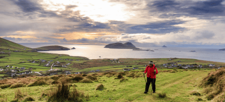
The Dingle Way is traditionally walked in a clockwise direction, starting out from Tralee and then heading along the northern slopes of the Slieve Mish Mountains. The route then branches south at the tiny village of Camp and crosses the peninsula towards Inch Beach. From there it moves on to the village of Annascaul, where you will find the famous South Pole Inn. The next stop is Dingle, the most westerly town in Europe, before the walk continues around the rugged westernmost point of Ireland at Slea Head.
The trail loops back to the north of the Dingle Peninsula via Dunquin and Ballyferriter, and then you will have the option to either make the climb over Masatiompan (at 650m, the highest point on the trail), or take a less strenuous alternative southern route over the shoulder of Mount Brandon into Cloghane. Next, there is a long, beautiful beach hike to Castlegregory, before heading back to Camp, and then retracing your steps to Tralee.
Terrain Overview
Most of the Dingle Way crosses low-lying land and looks up at mountains rather than down from them. The aggregate ascent over the route is approximately 2,900m, but, although there are some short steep ascents, there are almost no significant steep climbs. The exception to this is the traverse of Masatiompan (between Cuas and Cloghane), which sees the trail ascend to a height of 650 metres above sea level.
There is a wide variety of terrain covered by the Dingle Way and it consists mainly of quiet tarmac roads, mountain, field and cliff paths, and over 20km of good beach walking. Small roads, known locally in Ireland as ‘boreens’, make up a large part of the trail and help provide a quick walking pace.
Beaches make up a significant part of the Dingle Way, some of which provide an opportunity to take some weight off one’s weary feet by taking a swim. The remainder of the walk goes through open farmland and mountainous moorland.
Elevation profile


 symbol: this itinerary covers the entire Dingle Way trail.


